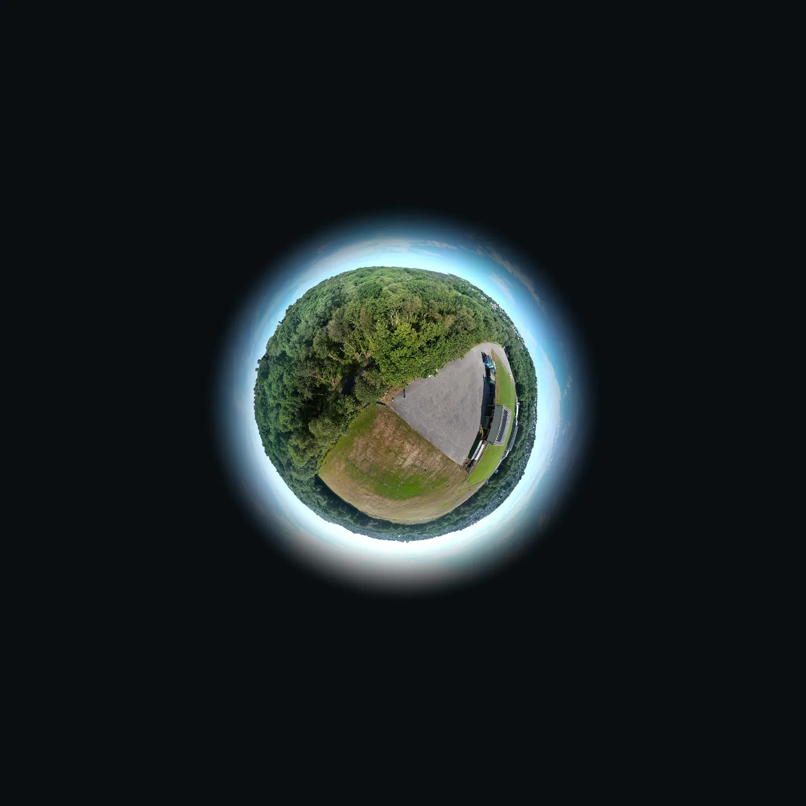
Every bearing.Every elevation.Captured.
We fly telecoms sites and buildings, then turn every frame into bearing-marked panoramas, segment maps and reports your team can act on.
- Height
- 24 m
- Bearing
- 240°
- Since
- 1992
01 / 04 · Height
Up to antenna height.
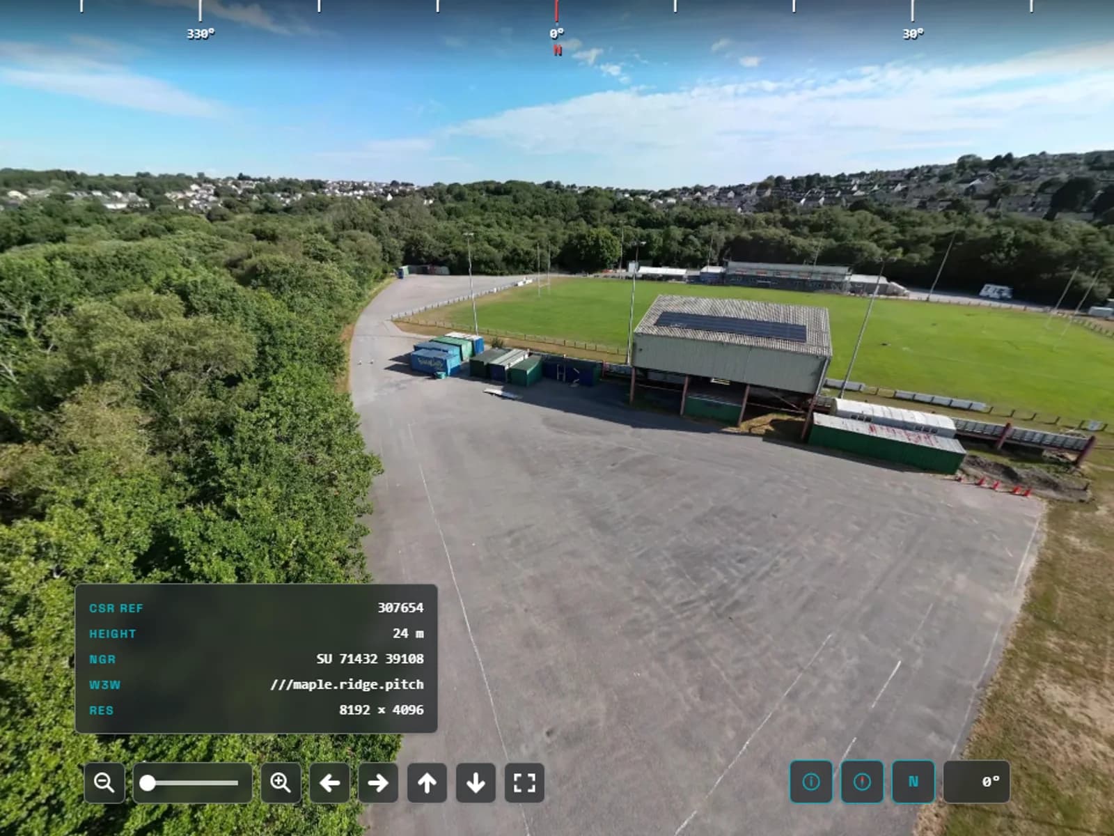
We fly to each antenna height on the structure and capture a full sphere. This one was taken at 24 m.
Telecoms panoramic surveys
The view fromevery antenna.
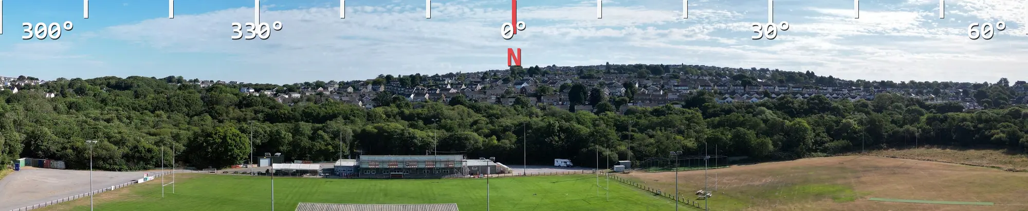
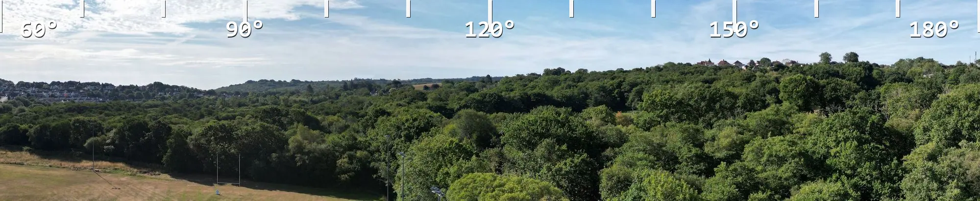
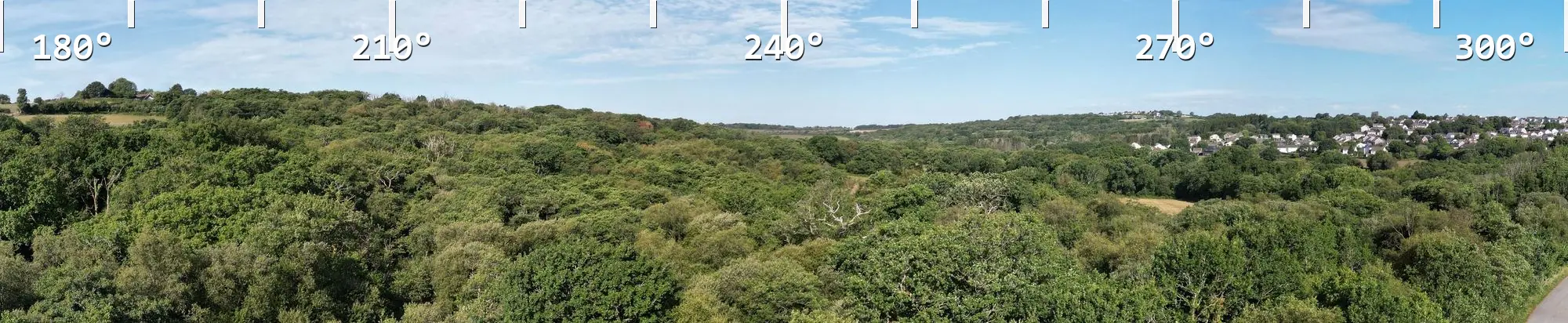
Full spheres at each antenna height, with bearings marked and north shown, so planners can see exactly what each sector looks at. We have done this for the telecoms industry since 2002, for every UK mobile operator.
Bearing strips
3 × 120°
The full circle in three wide stills, bearings along the top, ready for the report and the archive.
Interactive sphere
In the browser
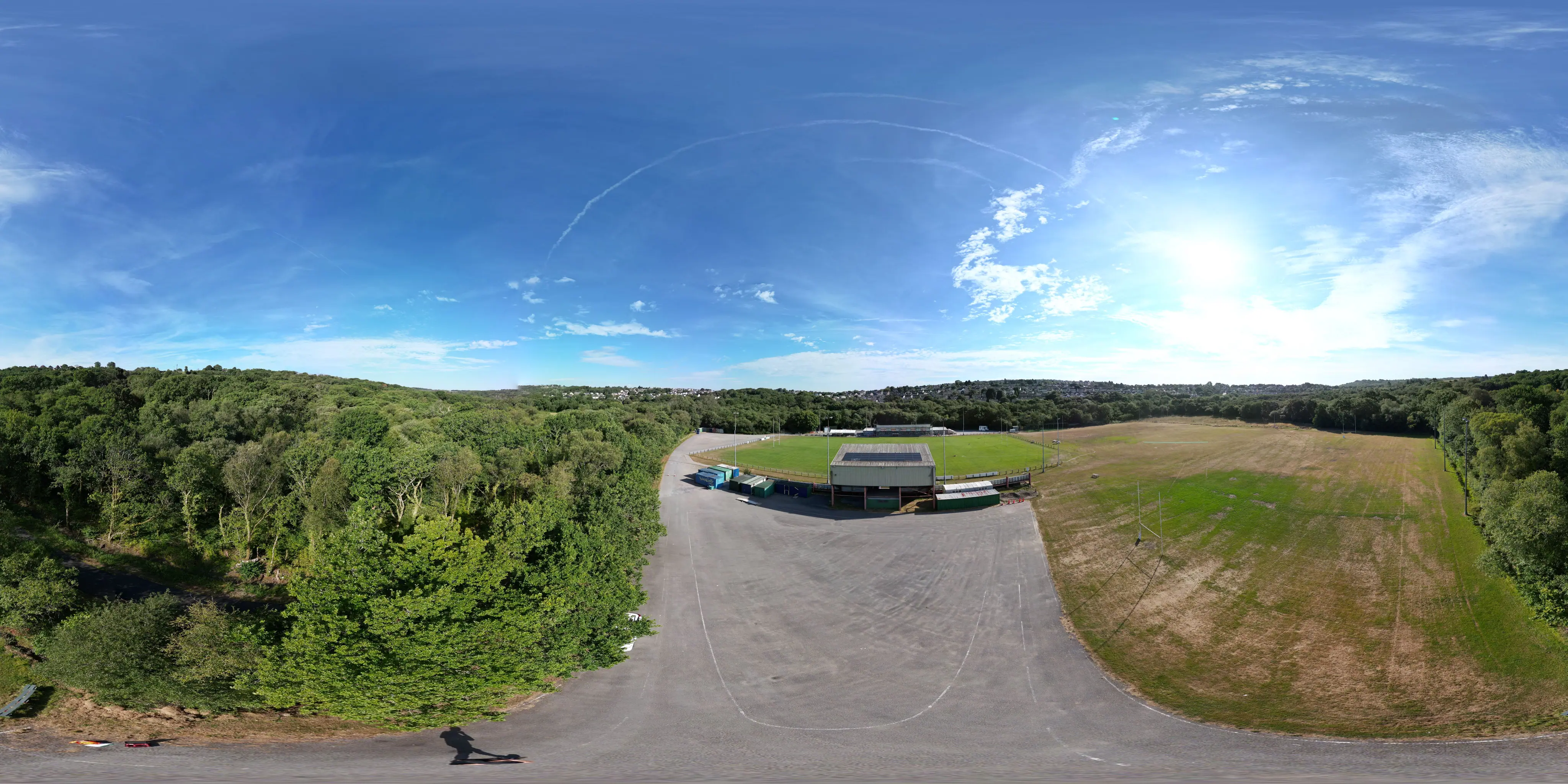
Drag to look round · Bearings on
Sample site card
- Height
- 24 m
- Grid ref
- SU 71432 39108
- what3words
- ///maple.ridge.pitch
- Sphere
- 8192 × 4096
Streetworks
Roadside poles and street furniture.
Greenfield
Masts and towers on open ground.
Rooftop
Installations on building roofs.
Streetworks, greenfield and rooftop sites, UK-wide.
Building Elevation Survey
Every face,segment by segment.
Roofs, chimneys, faces and gutters, photographed close up and mapped to exactly where each frame sits on the building. Visual documentation only, not a structural assessment.
01 / 03
Photograph the whole face.
Every elevation is flown end to end and kept as real frames. Nothing is stitched or redrawn.

02 / 03
Trace it and number it.
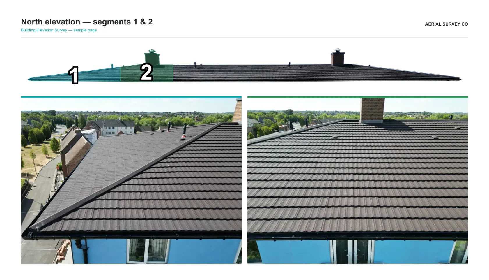
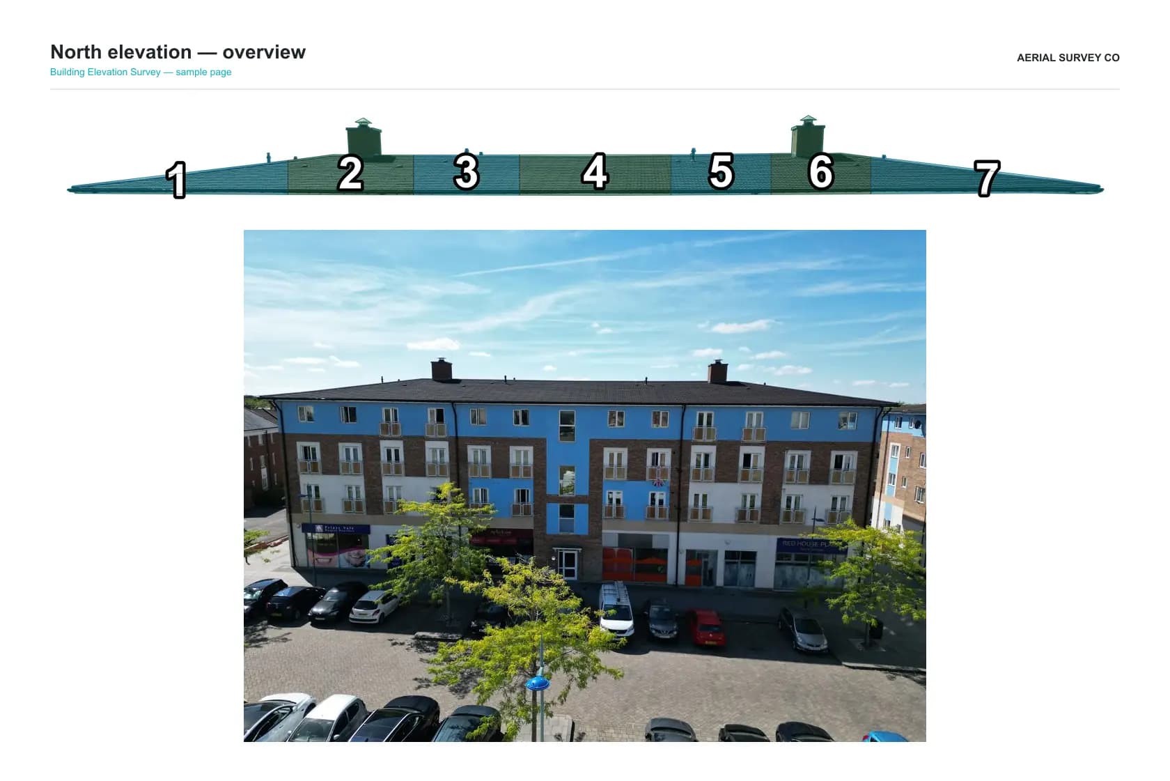
We trace the elevation and split it into numbered segments, alternating teal and green, so every photo has an address.

03 / 03
Pick out the features.
Chimneys, flues and other details are outlined in yellow and matched to their own sets of photos.

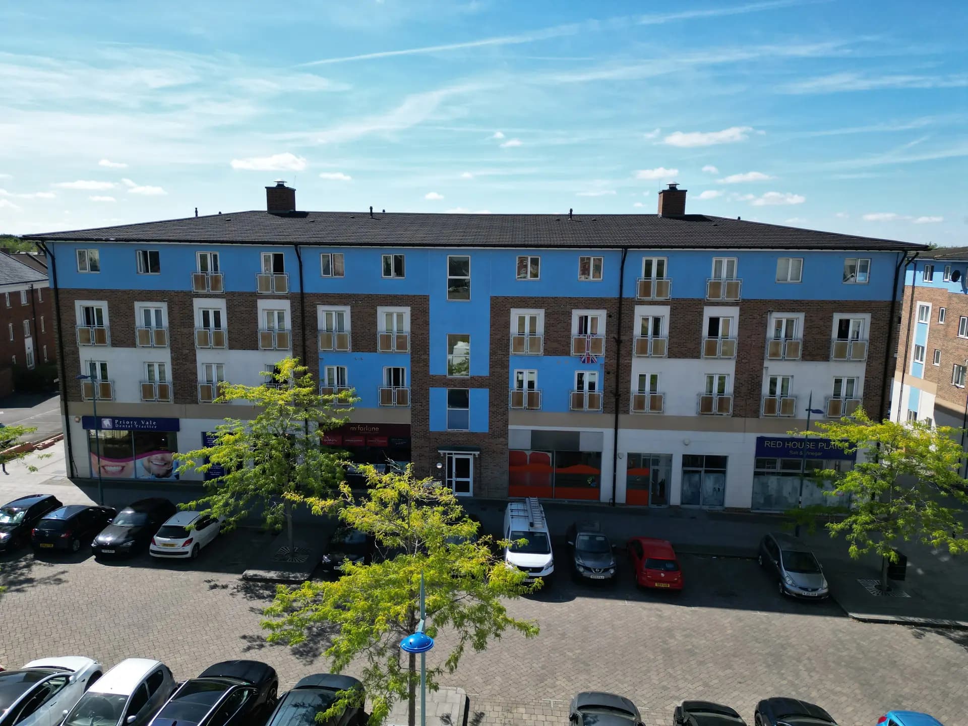
North elevation · overview
Full elevation · as flown
Try it
The map, live.
Tap a segment to open its photos, or switch to Features and step through a chimney, just as clients do in the delivered pack.
Segment 1 of 7 · tap the map
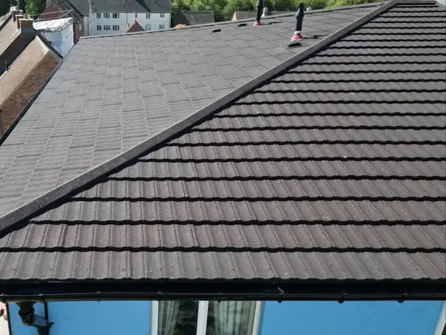
Roof · Chimney · Face · Gutters, in one survey that replaces our separate chimney and rooftop surveys.
What you receive
Reports peopleactually read.
Clean pages, clear numbering and a viewer anyone can open, showing the site exactly as it stands on the day.
01
PDF report pack
Landscape pages, numbered to match the map, with every photo where you expect it.
02
Interactive viewer
Spheres with bearings that open in any browser, with nothing to install.
03
The photo pack
Every frame, filed by segment or bearing, for your own records.
How it works
From briefto report.
Four steps, the same every time, so you always know what happens next and exactly what you will receive.
01
Scope
Tell us the site, the heights or faces you need, and when. We confirm access and send a quote.
02
Plan
We plan the heights, bearings and capture points before we arrive on site.
03
Capture
On site we fly and photograph: full spheres at each height, or every segment of each face.
04
Deliver
You get the report, the stills and the viewer, ready to share with your team.
1992
Founded in Swindon
2002
Telecoms surveys since
Every
UK mobile operator served
UK-wide
Coverage, from Swindon
About us
Surveyingsince 1992.
Formed in 1992 and incorporated in 1994, ATS Group Ltd has built its name on elevated photography, telecoms panoramic surveys and building elevation surveys, for clients across Swindon, Wiltshire and the wider UK.
We started out building drones and specialist kit, and that engineering habit shows in the work. Every survey is real photography, captured on site, then processed so you know exactly where each frame was taken: a bearing on a panorama, or a numbered segment on an elevation.
Our speciality is a bespoke service. We are always glad to talk through unusual or difficult sites.
Trading name
Aerial Survey Co is the name we use for survey work. The legal company remains ATS Group Ltd (Aerial Target Systems Ltd). Nothing about the business, CAA registration, insurance or client contracts changes; it is a trading name used publicly for surveys.
The parent site
Bespoke builds, CNC machining and prototyping live on the ATS Group site, a separate live site under the same company.
Visit ATS GroupTimeline
Thirty-odd years,five moments.
1992
Formed
The business begins as Aerial Target Systems, building experience in drones and specialist engineering.
1994
Incorporated
Incorporated as ATS Group Ltd, the company behind the work we still deliver today.
2002
Telecoms panoramas
Photographic and panoramic surveys for the mobile network industry become a core line of work.
2026
Building Elevation Survey
Segmented photographic elevations for roofs, chimneys, faces and gutters join the line-up.
Today
Aerial Survey Co
Survey work trades as Aerial Survey Co, while ATS Group carries on with bespoke builds, CNC and prototyping.
Who we work for
From masts tochimney stacks.
Mobile operators
Panoramic surveys at each antenna height, bearings marked, ready for planning.
Landlords and site providers
A clear visual record of the installation on your land or your roof.
Engineering partners
Stills, spheres and site facts to design against.
Building owners and managers
Roofs, chimneys, faces and gutters, photographed segment by segment.
All of our work is visual and photographic documentation. It is not a structural survey, a condition assessment or a measured survey.
Get in touch
Tell us whereto fly.
Send the site, the heights or faces you need and your timescale. We will come back with a plan and a quote. Unusual or awkward sites are welcome.